Description
DUALEM-4 and DUALEM-4S
The DUALEM-4 has 4-m separation between its transmitter and dual receivers, so its dual depths of conductivity measurement are 2 m and 6 m (by the 70-% cumulative-sensitivity standard).
The DUALEM-4 depths of measurements are well suited to a variety of applications in agriculture, geotechnics and hydrology. For metal detection, the DUALEM-4 can detect a steel drum to a depth of about 3 m.
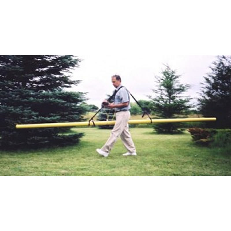
The double shoulder-harness and smooth tubular design make the DUALEM-4 practical for surveys by a single operator. Some users pull the DUALEM-4 on a cart behind a motor vehicle.
The DUALEM-4S is the sensor of the DUALEM-4, and it is available separately at lower price for integration with the user’s own surveying systems.
DUALEM instruments (e.g. the DUALEM-1) incorporate a DUALEM sensor as well as an internal WAAS-enabled GPS receiver, a hand-held weatherproof display/keypad/power-supply, a carrying harness and stabilizing feet.
DUALEM sensors (e.g. the DUALEM-1S) incorporate one-, two- or three-sets of the patented DUALEM dual-geometry array. Each dual-geometry array simultaneously measures conductivity and susceptibility to two distinct and easily quantified depths. Multiple measurements enable the estimation of the conductivity, susceptibility and thickness in a layered earth. The sensors internally record electromagnetic responses, positioning coordinates and values for time, pitch, roll, voltage and temperature from internal monitors.
DUALEM instruments operate by electromagnetic induction, so no contact with the ground is needed. This enables surveying at moderate speed over rough, dry or non-conductive terrain. Terrain that has been surveyed using DUALEM instruments includes deserts, forests, volcanic flows, and multi-year ice.
DUALEM instruments are calibrated precisely and permanently at the factory using a patented technique, eliminating problematic ad hoc calibrations in the field. Precise calibration, base-level stability, high sensitivity and advanced digital signal processing give the instruments unmatched accuracy.
DUALEM instruments are complete systems for positioned surveys in terrain and weather that may be challenging. The harness allows them to be carried close to the ground at walking speed, and the stabilizing feet are convenient for station-by-station measurements. They are often mounted on a sled or cart, and can be deployed underwater in watertight housing.
DUALEM sensors can be used with the user’s own control and positioning systems. LED lights on the sensors indicate the status of power and serial communication. The sensors receive text commands through their serial port, and provide text output in either NMEA0183-standard or 4-line by 20-character format. As NMEA0183 is the standard for GPS communication, a variety of GPS loggers and software can record DUALEM measurements and integrate them with GPS positions.

